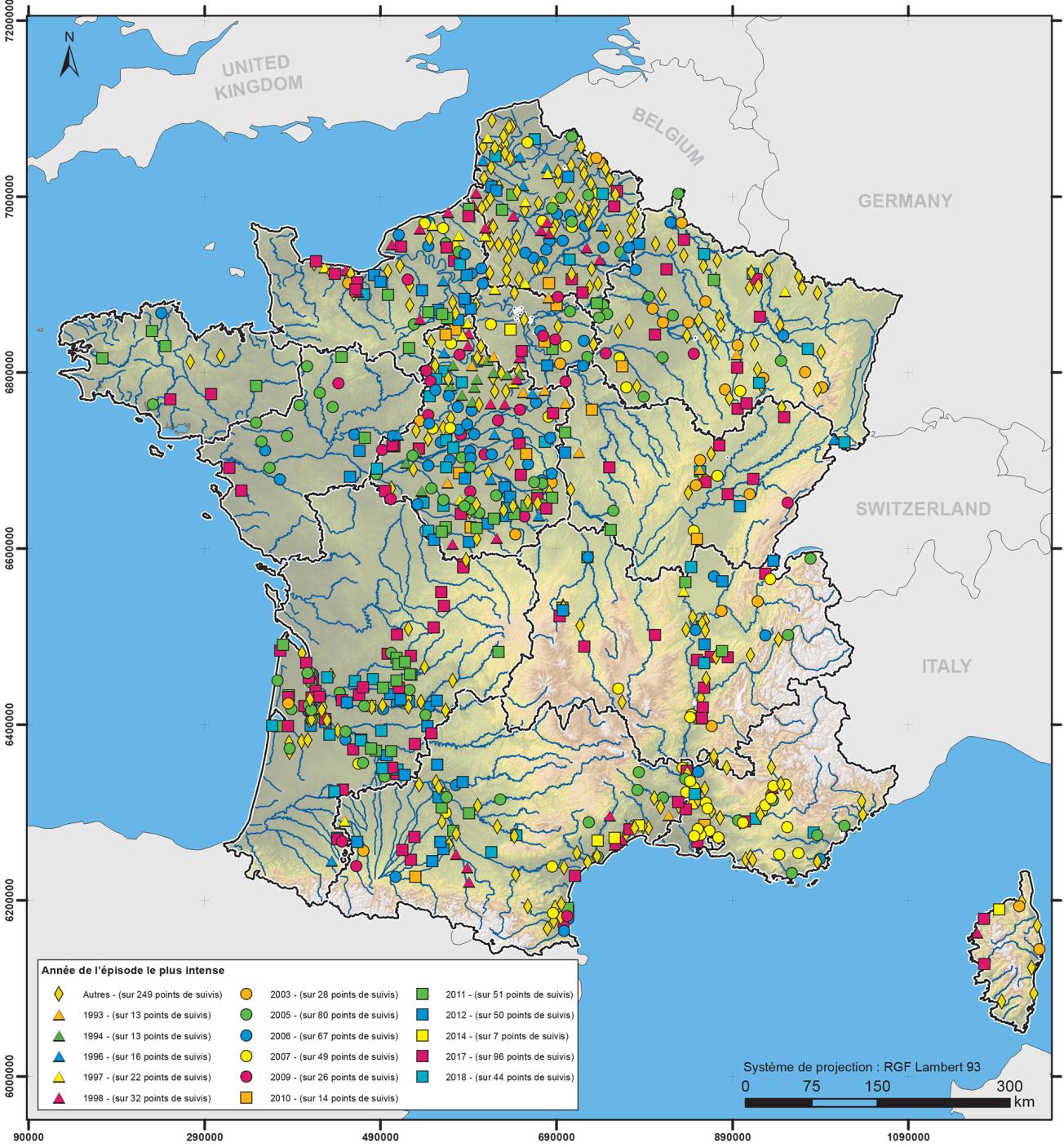
Map showing the year of the most intense hydrogeological drought event for each groundwater monitoring point with data covering more than 13 years.
© BRGM
The need
Until 2017, the groundwater status indicator, calculated for the “water table” edition of the Bulletin de Situation Hydrologique (Hydrological Situation Report, or BSH) published by EauFrance, which describes the quantitative situation of hydrosystems in terms of groundwater level, was graduated according to a scale defined in terms of the time taken to return to previous levels (five years dry, ten years dry, etc.). But such a probabilistic approach requires accepting a certain number of hypotheses, in particular the stationary nature of piezometric chronicles and the independence of successive values. These conditions are not always met, for example with multi-year cycles in which groundwater levels are highly self-correlated, or with aquifers with a continuous upward or downward trend. This is why a new indicator of groundwater conditions has been defined, the Standardised Piezometric Level Indicator (SPLI).
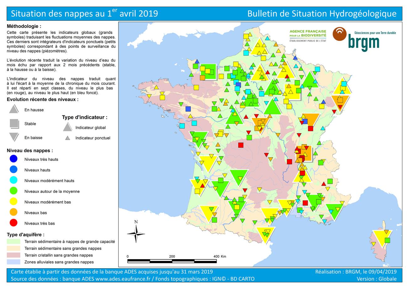
Map of the Hydrological Situation Report on 1 April 2019, showing the point and overall state indicators calculated by the SPLI according to 7 classes.
© BRGM
The results
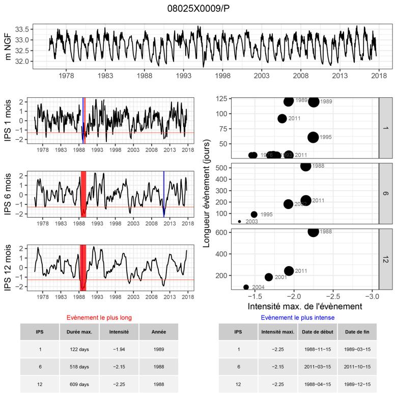
The calculation method for the SPLI not only overcomes these weaknesses but is also consistent with the indicators used by Météo France (SPI – standardised rainfall indicator and SSWI – standardized soil moisture index), which among other things, facilitates the comparison of groundwater conditions with climatic episodes. In addition to the SPLI, about thirty parameters are calculated, providing a complete description of the piezometric chronicles.
The method has been tested on more than 200 long-term piezometric chronicles (>30 years), recorded on different types of aquifers, and has shown the benefits of the indicator, which can be used, on a monthly scale, as a short-term indicator in conjunction with the SPI and the SSWI, or annually, as a trend indicator of aquifer states. The SPLI has several advantages: it can be applied to all aquifers, the scale of values is common to all types, which makes it possible to compare them with each other, facilitates the calculation of the overall indicator for individual aquifers and means it can be used as a status indicator, which in turn makes it possible to monitor the situation of an aquifer over the long term.
Ideally, SPLI calculations require chronicles covering periods of at least 30 years. But by taking a period of 15 years, with an acceptable bias, it is possible to take into account most (234/250) of the piezometers used for the current BSH.
Using the results
The Standardized Piezometric Level Indicator, which has been used systematically since 2017 for the implementation of the national “water table” BSH and by various regional actors, meets the need to assess the quantitative situation of groundwater resources at the national level and provides synthetic information used in prefectoral ordinances to limit water use during critical periods of drought. Specialists can use the SPLI to quantify the severity of a drought episode (duration, intensity, magnitude) and also to better define a hydrogeological drought episode by calculating the duration and intensity of the extreme event. The indicator can also be used for flood episodes related to rising groundwater levels. Available under ADES (ades.eaufrance.fr), the SPLI covers seven classes ranging from very low to very high levels. The overall indicators are calculated from the point indicators attached to it.
The partners
- French Agency for Biodiversity
- MTES/DEB
The SPLI, as developed by BRGM, changes two fundamental things: it is an excellent indicator of groundwater status that enables us to abandon a purely statistical approach, and it allows comparisons between different points or aquifers or structures. But it does not allow us to qualify low water levels with sufficient precision to determine whether we can expect major difficulties. Nor does it include the concepts of vulnerability or risk. It therefore still needs to be completed to provide decision-makers with the best information when preparing prefectoral ordinances in the event of drought, for example.

