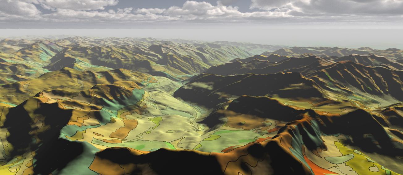
Extract from the RGF 1:50 000 geological map of the Pyrenees draped over a digital elevation model (Pyrenees, 2015).
© BRGM
The RGF programme developed by the BRGM is designed to become the "bedrock" of geological knowledge on France.
For reasons of societal and academic research interest, the Pyrenees and its surrounding lowlands were selected for the first full-scale application of the RGF concept.
Over five years, the RGF Pyrenees project delved into 600 million years of Pyrenean geological history. The first results were presented by the BRGM in Pau during a two-day scientific seminar.
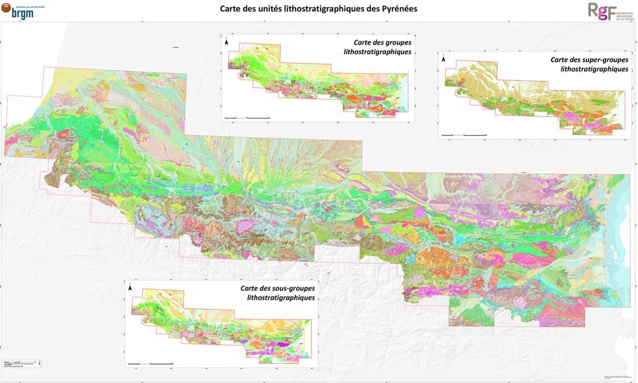
A single geological map of the Pyrenees to the scale of 1:50 000
The studies undertaken have produced continuous, consistent and homogeneous data on the entire Pyrenean range, which have been used to produce a single 1:50 000 geological map now available on the InfoTerre website.
The scientific results brought answers to some of the remaining fundamental unresolved questions on the geology of this mountain range. One of the most important discoveries concerns our understanding of the initial genesis of the Pyrenees 100 million years ago.

The unified 1:50 000 map of the lithostratigraphic units making up the Pyrenees.
© BRGM
A federating goal for the geoscience community
The RGF programme is working to compile, reinterpret and unify different sources of data on the surface and sub-surface into a single map, including data from geological maps, the subsoils databank and petroleum and geothermal boreholes. All the information is to be compiled into a digital platform that will evolve with continuous updates from the latest scientific advances in geological knowledge. The programme fulfils the aims of transdisciplinarity and knowledge pooling across the entire geosciences community.
The ultimate aim of the RGF programme is to produce a multi-scale three-dimensional representation of France's geology, showing the physical properties of rocks. "We have laid the foundations for the future of mapping: the RGF programme has revolutionised the geological mapping approach, which could not previously handle changes in concepts", says Thierry Baudin, director of the RGF Pyrenees programme.
The RGF is a strategic programme for the BRGM and the entire scientific community. Because it offers solutions for planning issues, natural resource management and seismic and flood risk prevention, it is fully consistent with our key role of supporting public policy development. Full deployment of the RGF programme over the whole of France may take up to thirty years. The concept, which has no equivalent elsewhere, could ultimately be developed internationally.


